Search

Steve Bruno Photo

Category

nature

Powerball Fever

Powerball fever has been sweeping the nation with its unprecedented $1.6 Billion jackpot. Here in Nevada, people have to drive to California or Arizona to purchase tickets. The gaming lobby will probably see to it that remains that way.

The closest place for Nevadans to buy tickets is the California state line on Interstate 15, at a gas station with ticket sales. Similarly, Arizona has a store in the middle of nowhere about twenty miles after crossing Hoover Dam. News footage for the last couple drawings has shown tremendous lines for the people in the Cali location. I doubt Arizona has been much different.

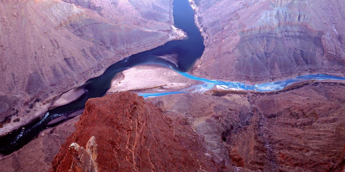
I succumbed to the madness and headed down to Arizona yesterday. Not to the forementioned location, but down to Bullhead City. With those ridiculous odds against me purchasing a winning ticket, I wanted to make sure I had something to photograph along the way. Not too long ago, the road through Bullhead City used to be the way between Nevada and Arizona. The post 9/11 security checkpoints for those crossing Hoover Dam made for backups several miles long most of the day. Sitting in a parked or idling car for 2 or more hours was not uncommon. The only time you could guarantee a timely crossing was between 1am and 7am.

One time I guessed wrong, and headed towards the dam on my return trip. It was late at night, on a weekday, with light traffic. About 3 or 4 miles before the dam, all traffic came to a stop. We were there almost 20-30 minutes without moving an inch. A passenger in the car in front of me decided he had to use the restroom, so he got out of the car and crossed over the guardrail, and away from view. About the same time, we started moving. Not just a little bit. Strangely, traffic got up to about 25 mph and didn’t come to a stop for about a mile-and-a-half. The driver of the car in front of me, afraid to lose his place in line, never pulled over to wait for his passenger. I’ll bet that was the last time those two ever rode together!

Enough of the good old days, back to yesterday.

I went to Bullhead because I wanted options. If I got numbers that looked like they had zero chance of ever coming up together, I didn’t want to have to go back in a line. And forget lines. With multiple locations selling tickets, lines weren’t an issue. I was out of there quickly, and headed back to what I really wanted to do.

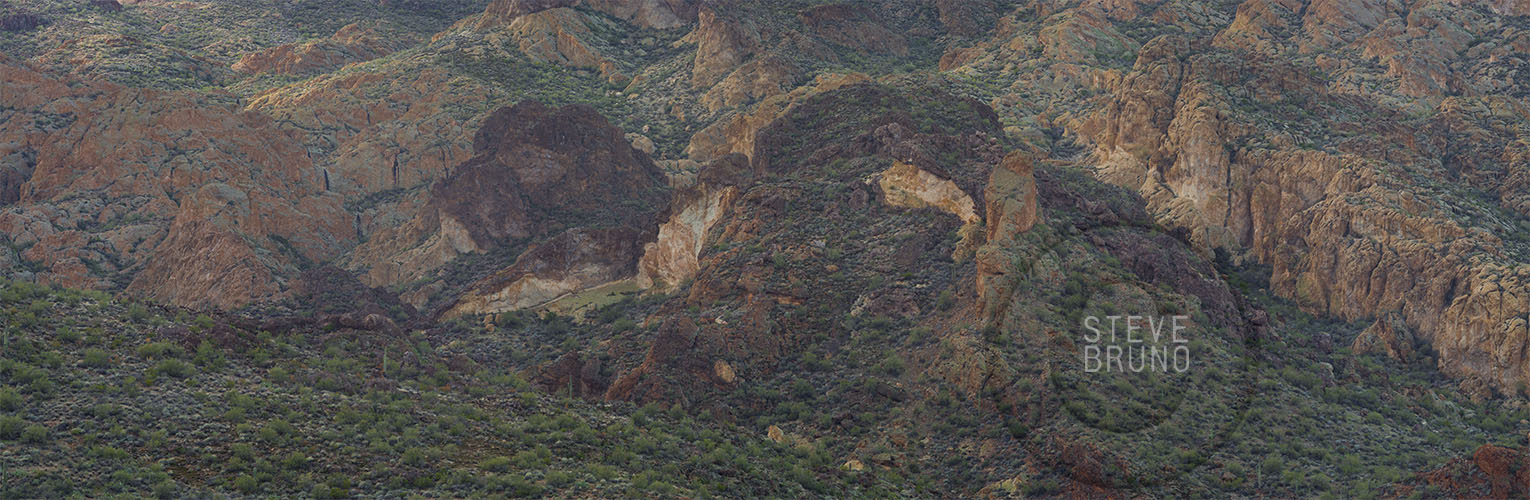
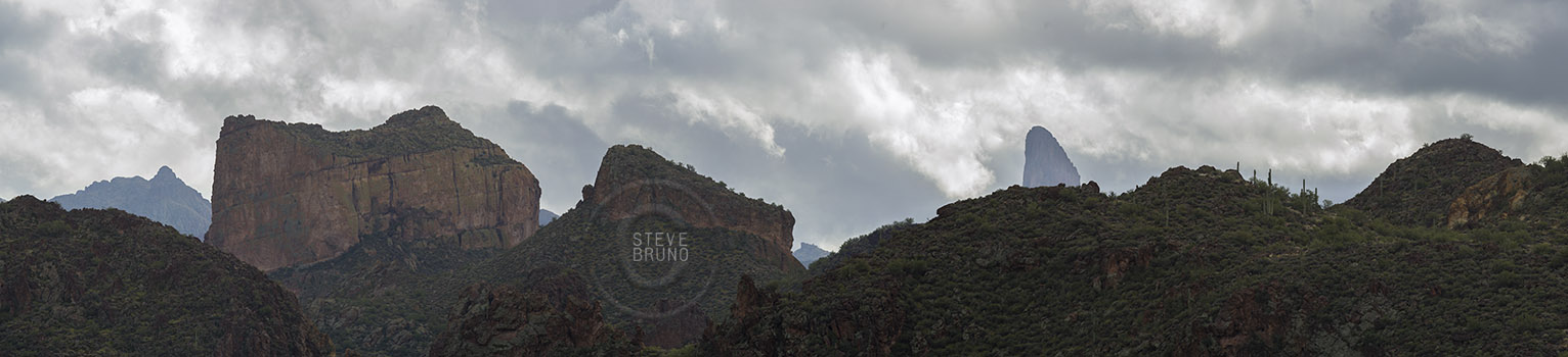
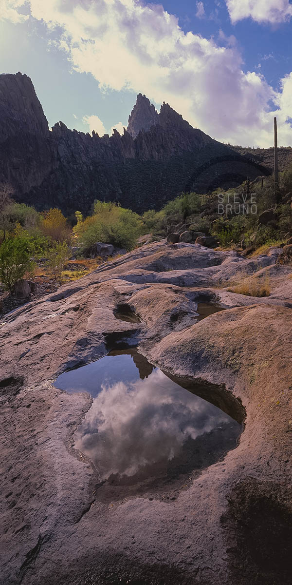
As one drives back into Nevada and heads up the hill, the Newberry Mountains are one of the first things that come into view. I had driven past these mountains so many times before with the light being wrong. I kept telling myself I would have to come back and camp, because it needed to be a sunrise or sunset shoot. The Hoover Dam bypass opened in 2010, and I forgot about coming back here.

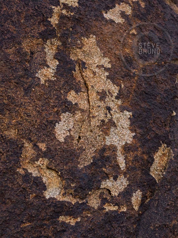
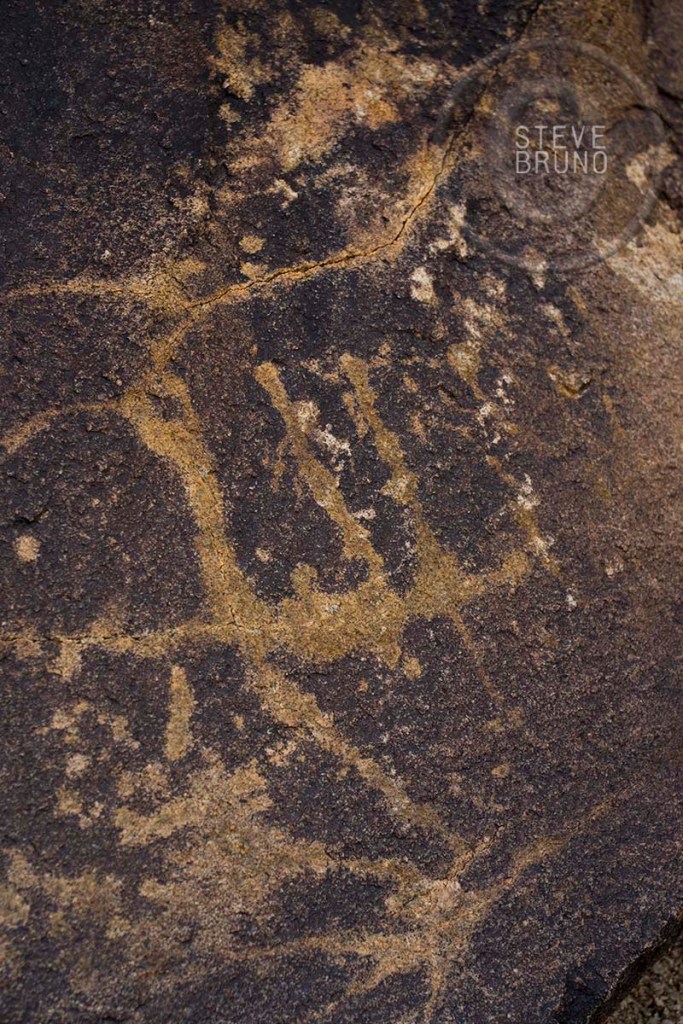
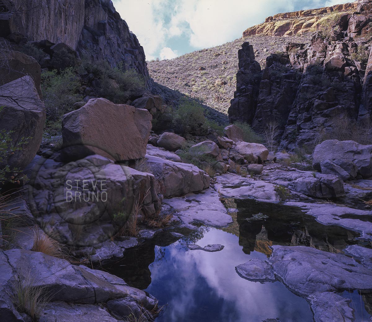
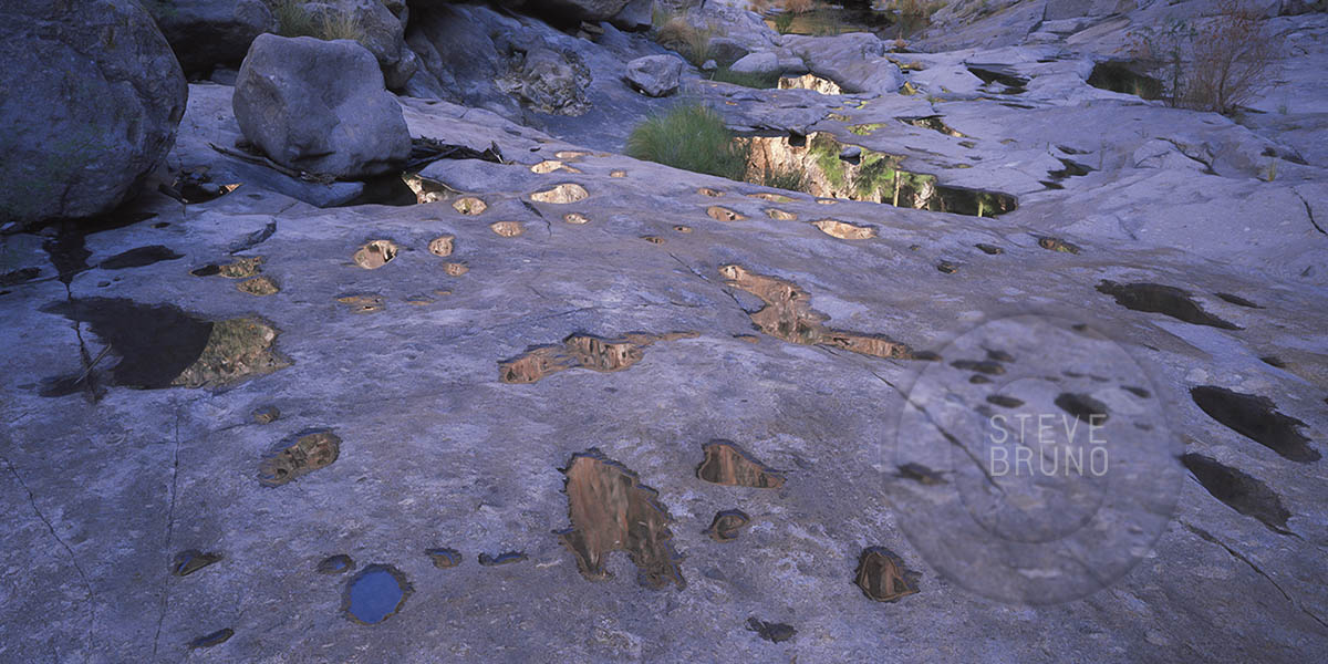
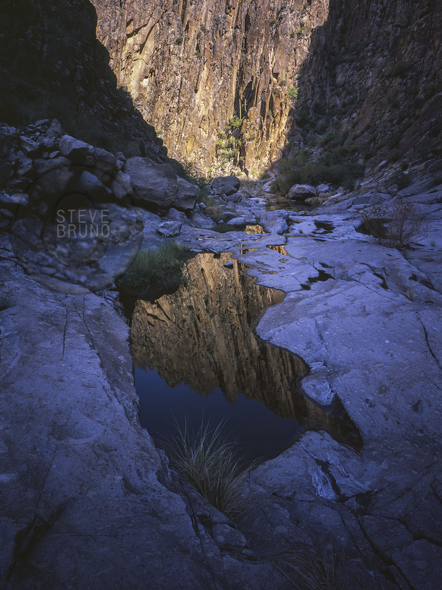
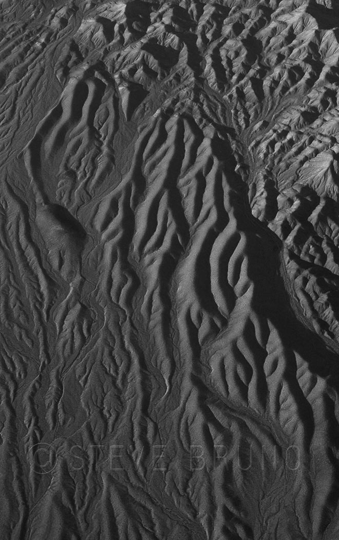
This was my first option for photographing on my return trip, and with soft, mostly overcast light, it was the one I took. There are huge outcrops of whitish granite along this edge of the Newberrys. The road that leads close to the mountains is marked with a sign pointing to Christmas Tree Pass. This is the desert, and that means Junipers, not Douglas Firs. Soon after the junction with 95 north to Vegas, you will see a similar sign where the road comes out. The boulders are in close proximity here, and this is the spot I chose to explore. One of the first things I came across was a rock that looked like it had a petroglyph in the shape of a Christmas tree. Whether man-made or naturally occurring, it made me ponder the origin of the name of the nearby pass. Were there more of these symbols nearby? Not far from there, I came across another symbol which looked more like a discoloration than something pecked into the rock. I took a photo anyway.

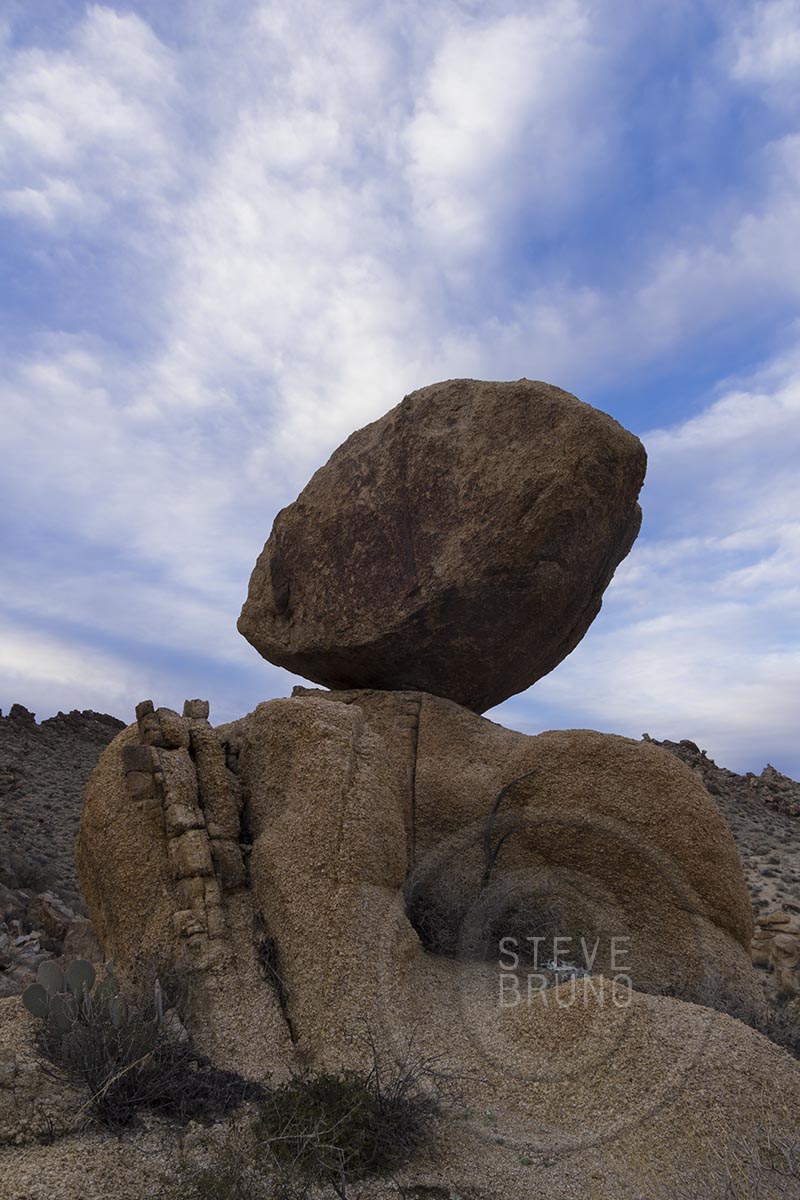
As I covered more ground, I was soon amongst some larger boulders. One of them, a rounded balanced rock, caught my attention. Now that’s nature’s Powerball! I managed to take photos from a couple angles, then sat down and enjoyed the sandwich I had purchased down in Bullhead. From here I could see the town, yet everything was so quiet and peaceful. Even the sounds of the highway were completely absorbed into the lower hills. As I finished my sandwich, I could tell the light was changing into the golden hour. I walked some more, and came across another spectacular granite boulder. This one was perched on a ridge, and erosion was taking the hill underneath, leaving small openings below the boulder. In almost no time the sun was breaking through the bottom of the cloud layer and igniting the mountains in Arizona. I didn’t want to be caught out here in the dark, so I packed quickly and headed down to my car. I approached the ridge above my car just as the sun was throwing its last light into the cloud layer. Okay, just one more!

I don’t know about my lottery tickets, but I felt like I had a winning afternoon. I finally had a reason to wander into the Newberry Mountains.

Mid-week Mixings: Boulder Canyon Hike

My work schedule has been crazy for about the last month, and it’s been amazing that I’ve found any time to check in on this blog.  Fortunately, there was one break in the action, Christmas, where most of my family members gathered in Phoenix.  Some of them wanted to go for a hike.  Their criteria was a trail that was easy to get to, not too demanding, and had something to offer in a short amount of time.  No problem, I have it covered!

Boulder Canyon Trail takes off from across the marina at Canyon Lake, east of Phoenix.  Our group consisted of people of various ages and hiking abilities, and it was really just an excuse to be out with family and get in a little exercise.  The trail doesn’t have any steep sections in its entire length, and we just went to the point where one can see into Boulder Canyon. This was probably less than a mile from the parking lot.


I had taken this trail further a number of years before.  After the overlook, the trail descends into Boulder Canyon, and continues in the bottom for a couple miles.  There are no steep grades or any boulder hopping, as the name might suggest.  It’s probably close to the four mile point where the canyon gets quite photogenic.  The Superstition Wilderness is full of spires and odd shaped rocks, but there is one of the most interesting peaks in this range just before the trail heads into the narrowest part of the canyon.  In this narrow part, the bottom of the canyon becomes mostly solid rock, and if you time it right – water.  The following photos are from my previous trip.


WPC: Weight(less)

Lower North Falls - Steve Bruno
Lower North Falls flows over massive slab of rock in Silver Falls State Park, Oregon. Photo by Steve Bruno

For this week’s Daily Post Challenge, I have another shot from my trip to Silver Falls State Park in Oregon.  I chose this shot for two reasons.  The water falls, obviously, due to gravity, but that slab of rock that the water flows across is cut very deeply underneath.  There is a tremendous amount of weight that is defying gravity by not collapsing here.

Mid-week Mixings: South Falls

South Falls-Silver Falls SP-Steve Bruno

Last year, around Thanksgiving, I was visiting family near Portland, Oregon.  I took a day to head out to Silver Falls State Park.  As the sun moved across the morning sky, its lower path didn’t clear the trees behind South Falls.  About the same time, the breeze kicked up a bit and lifted the mist created from the falls.  I had been to this spot before in summertime, but didn’t witness this incredible timing of light and elements on that visit.

WPC: Oops!

In my first year of shooting with a 4×5 camera, there were two occasions where I ended up double exposing a sheet of film because I wasn’t paying enough attention to the dark slides as I placed them back into the film holders them post-exposure.  Oddly enough, both mistakes turned out really well, and encouraged me to practice this deliberately from time to time.

This shot was taken overlooking the West Fork of Oak Creek Canyon in Arizona.  I took one exposure with the closest thing I had to a ‘standard’ lens, then switched to a more telephoto lens, thinking I was exposing a different sheet of film.  The enhanced layering effect made this one my favorite mistake.

In response to the Daily Post Challenge: Oops!

Window Seat IV – Storm Front Sierra Nevada

The territory covered on the flight from Las Vegas to Seattle can be quite spectacular, and my recent trip along this route coincided with the arrival of a storm front that allowed me to capture some of my favorite images ever from the air.  We had passed Death Valley and still hadn’t reached full altitude when we came across this scene.  I probably would have been thrilled to be on the ground for this one, especially if I were close to one of the snow-capped ridges in the distant range.  Stepping back and seeing the whole picture can be good once in a while, and in this case, seeing below the clouds and the top of the approaching front made for a unique perspective I was glad I was able to photograph.

Window Seat III – Above The Clouds

When I’m flying, I spend most of the time with my eyes peering out the window, fixated on the shapes of the landscape only available through an aerial perspective.  Every once in a while, it’s the clouds, not the land that captures my attention.

The photo above, was taken over the waters of the Gulf of Mexico.  In the absence of any features of the land, the shadows of the clouds stretched uninterrupted across the open water in the late afternoon.

Also in a late afternoon setting, the plane had turned perpendicular to the line of the sun, allowing for this lighting pattern on the top of the cloud layer. I’ve seen this effect on takeoffs and landings emerging through low clouds, but not from this height.

Clouds
Sunburst pattern on top of cloud layer. Photo by Steve Bruno.

Then there are the occasions when cloud layers become prominent, creating a depth as rich as any landscape.

Florida Clouds
Multiple layers of clouds off the coast of Florida. Photo by Steve Bruno.


Wordless Wednesday: Window Seat II

Window Seat

WPC: (Extra) Ordinary

Setting sun illuminates part of the cloud cover over the Atlantic Ocean. Photo by Steve Bruno.

An ordinary day on the Atlantic Ocean in Florida.  There were no dramatic waves nor spectacular storm clouds.  As the sun was setting, only two patches of cloud remained lit.  I loved the way they reflected shafts of light across the water and into the sandy area where the waves were receding.  To me, that’s what made this shot stand out from the rest I took that day.

In response to The Daily Post’s weekly photo challenge: “(Extra)ordinary.”

Wordless Wednesday: Window Seat I

Window Seat

Wordless Wednesday: Colorado Gold

Colorado Gold

WPC: Possibly Horrendous Change

The Grand Canyon is one of earth’s special places, and even in special places you come across spots that are extra incredible.  The photo above is the confluence of the Little Colorado and Colorado Rivers in Grand Canyon National Park, Arizona.  During the majority of the year it looks like this.  The turquoise colored waters of the Little Colorado, coming in from the right, are fed from a highly mineralized spring about six miles upstream.  The Colorado’s waters come from Glen Canyon Dam, which filters out most of the sediment, leaving a deep green hue to the water, when the sunlight hits it.  If there is a flood in the vicinity, either, or both, will turn muddy before returning to this two tone mix.

For this week’s challenge, I thought the changing of the Little Colorado’s waters after mixing with the larger volume of the main river showed the visual aspect of change.  But there’s a far deeper issue of change at stake.  The photo above is in National Park property, but about a mile east, just outside the right edge of the frame, is the boundary with the Navajo Indian Reservation.

A project called the Grand Canyon Escalade is still being considered to be built in the Navajo lands at the edge of the national park.  The project’s main feature would be a gondola estimated to bring up to 10,000 people a day into the canyon.  At the bottom would be restaurants, shops, an amphitheater and elevated riverwalk.  You can also add toilets and garbage to that list.  On the rim would be hotels and an RV center plus more of the previously mentioned items.  They seem to have omitted where the water supply would be coming from.

The Escalade idea came from developer R. Lamar Whitmer, with the project offices based in Scottsdale, Arizona.   Mr. Whitmer has several arguments for his cause, including making this area “accessible to those who might never get to enjoy the tranquil isolation at the bottom of the canyon”.  Have you been to Mather Point on the South Rim, Mr. Whitmer?  There can easily be a thousand people there at sunset, and the words “tranquil isolation” are the furthest thing from my mind.  I can’t imagine experiencing tranquil isolation with thousands of strangers in this tight little pocket of the canyon.  That is where raft trips fill the need quite well.

The major selling point of this project was jobs for the Navajo Nation, where unemployment is incredibly high.  Nobody could possibly be against that, or could they?  Written into the contract is a non-compete clause for 40,000 acres along access roads.  It seems all those jewelry stands run by nearby families would have to go, among others.  And how about that corporate address?  I would have an easier time believing that the Navajos’ best interests were at stake if it was based in Window Rock, or Cameron, or even Flagstaff.  Are the Navajo workers supposed to move or commute to Scottsdale?  Or are the Navajos not even being considered for corporate level jobs?

This project is completely in the hands of the people of the Navajo Nation.  There is nothing that US citizens or the US government can legally do to prevent this from becoming reality.  The nearby Hopi tribe has no say in the matter, either.  The spring which feeds the Little Colorado is one of the Hopis’ most sacred sites.  Fortunately, newly elected Navajo President, Russell Begaye, is against the Grand Canyon Escalade.  This is probably the best news to come about since this idea first started.  His predecessor was completely for it.

In addition to the impact in the immediate area, this eyesore will be visible from many points along the South Rim, and those points on the eastern drive of the North Rim.  The spot I was standing, even though considered backcountry, used to have a rough road leading all the way out to the overlook.  Very few people knew of this, but it only took a couple of disrespectful people, having bonfires and leaving trash, to make it so you have to walk the last five miles now.  I wonder what the impact will be when the numbers are in the thousands?

I really don’t want to add this to my historical photograph collection.

In response to The Daily Post’s weekly photo challenge: “Change.”

Blog at WordPress.com.

Up ↑