My work schedule has been crazy for about the last month, and it’s been amazing that I’ve found any time to check in on this blog. Fortunately, there was one break in the action, Christmas, where most of my family members gathered in Phoenix. Some of them wanted to go for a hike. Their criteria was a trail that was easy to get to, not too demanding, and had something to offer in a short amount of time. No problem, I have it covered!
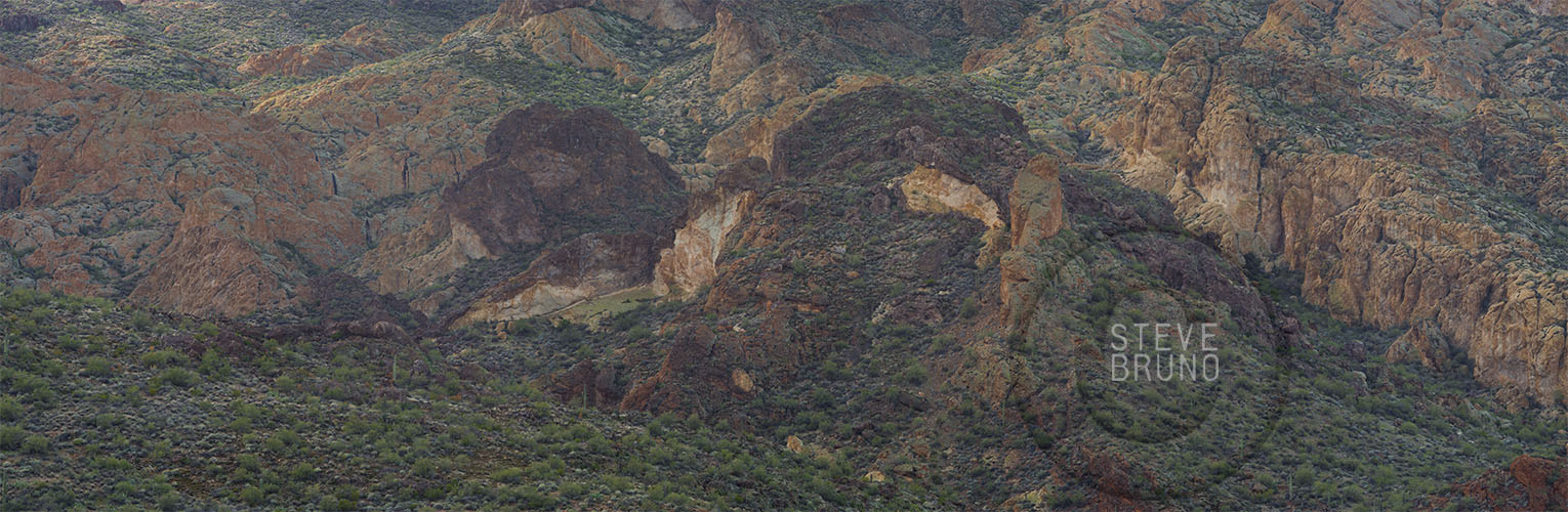
Boulder Canyon Trail takes off from across the marina at Canyon Lake, east of Phoenix. Our group consisted of people of various ages and hiking abilities, and it was really just an excuse to be out with family and get in a little exercise. The trail doesn’t have any steep sections in its entire length, and we just went to the point where one can see into Boulder Canyon. This was probably less than a mile from the parking lot.
Colorful cliffs above the early part of the trail in Boulder Canyon. Photo by Steve Bruno.
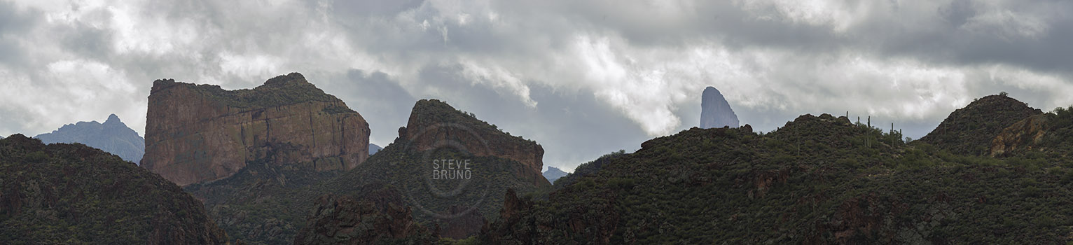
In the early part of the trail there is an overlook of Boulder Canyon’s cliffs, and Weaver’s Needle in the Superstition Wilderness, Arizona. Photo by Steve Bruno.
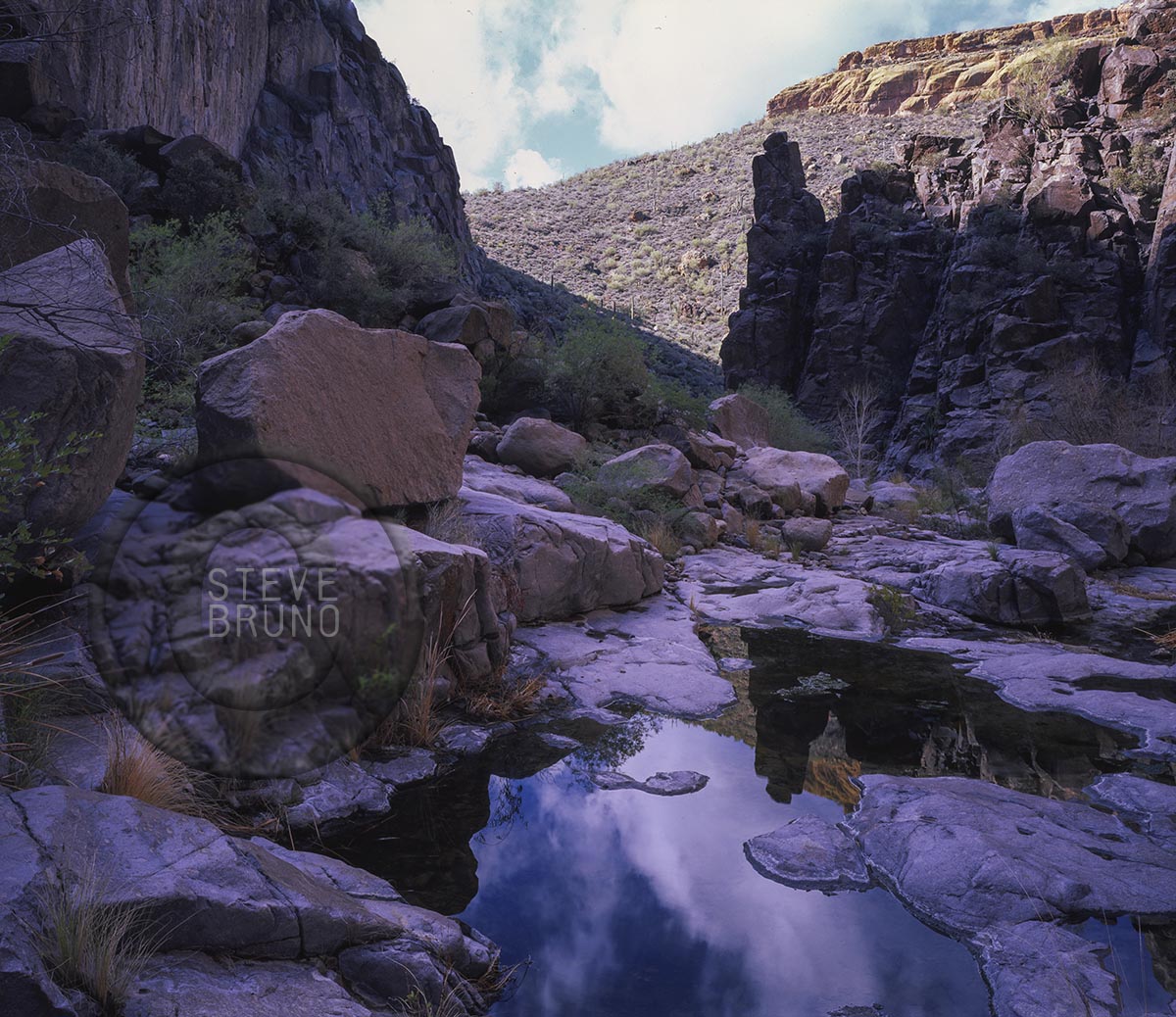
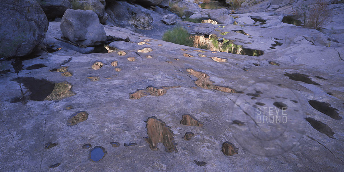
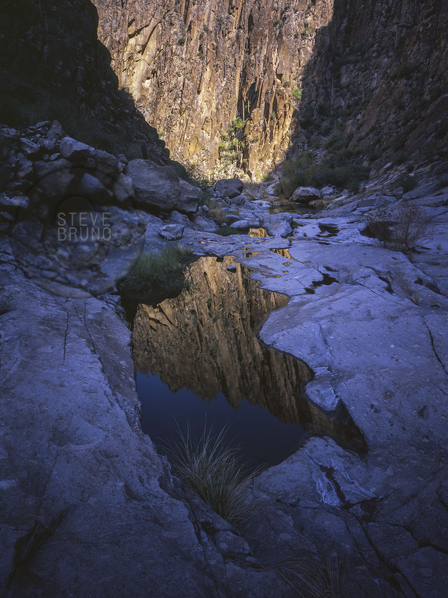
I had taken this trail further a number of years before. After the overlook, the trail descends into Boulder Canyon, and continues in the bottom for a couple miles. There are no steep grades or any boulder hopping, as the name might suggest. It’s probably close to the four mile point where the canyon gets quite photogenic. The Superstition Wilderness is full of spires and odd shaped rocks, but there is one of the most interesting peaks in this range just before the trail heads into the narrowest part of the canyon. In this narrow part, the bottom of the canyon becomes mostly solid rock, and if you time it right – water. The following photos are from my previous trip.
Sunlight starts to make its way into Boulder Canyon. Photo by Steve Bruno.
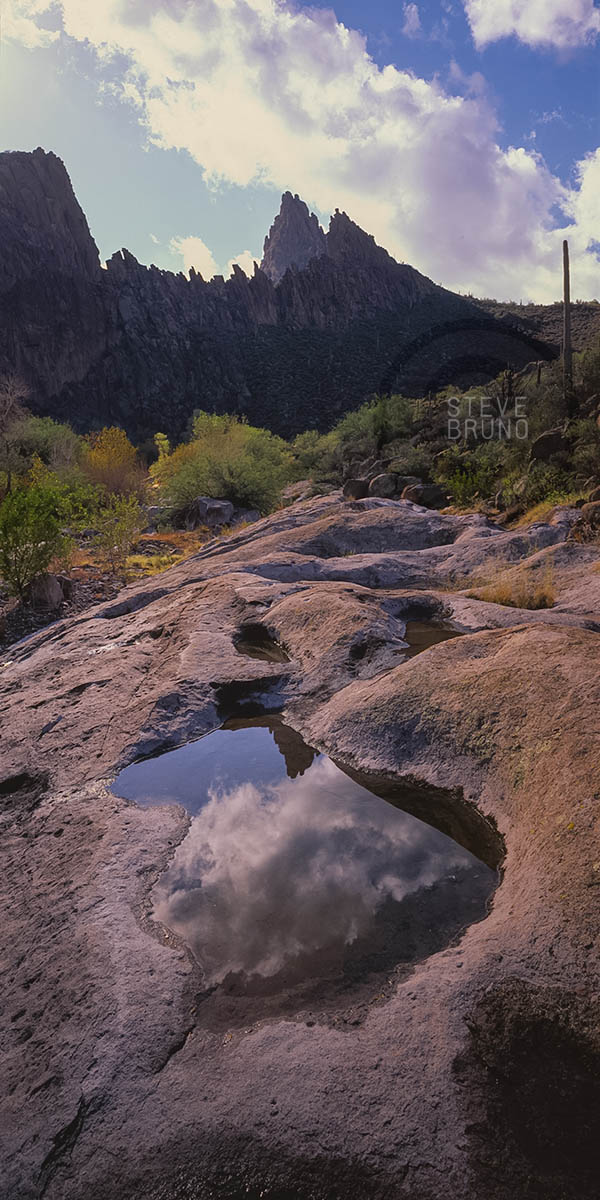
Tiny rainwater pockets in the canyon bottom of Boulder Canyon, Superstition Mountains, Arizona. Photo by Steve Bruno.
Sunlight at the end of the canyon, reflected in a pool in Boulder Canyon, Superstition Wilderness, Arizona. Photo by Steve Bruno.
Jagged peaks above Boulder Canyon, Superstition Wilderness, Arizona. Photo by Steve Bruno.
Lower North Falls flows over massive slab of rock in Silver Falls State Park, Oregon. Photo by Steve Bruno
For this week’s Daily Post Challenge, I have another shot from my trip to Silver Falls State Park in Oregon. I chose this shot for two reasons. The water falls, obviously, due to gravity, but that slab of rock that the water flows across is cut very deeply underneath. There is a tremendous amount of weight that is defying gravity by not collapsing here.
Last year, around Thanksgiving, I was visiting family near Portland, Oregon. I took a day to head out to Silver Falls State Park. As the sun moved across the morning sky, its lower path didn’t clear the trees behind South Falls. About the same time, the breeze kicked up a bit and lifted the mist created from the falls. I had been to this spot before in summertime, but didn’t witness this incredible timing of light and elements on that visit.
As an old friend used to say, “Every day above ground is a good day!” Some days stand out more than others, and here’s one that I still remember.
My friend Dave asked me to join him checking out a hike he had read about. It was the Taylor Creek hike in the Kolob Canyons section of Zion National Park in Utah. The National Park Service lists this as a 5 mile roundtrip hike that only gains 450 feet. Dave and I both have extensive hiking experience, including the Zion Narrows and many Grand Canyon hikes, so this sounded like something we would knock out in about 2 hours. The official trail ends at Double Arch Alcove, but he had read that going further up canyon was worth investigating. Even then, we both had the feeling we would be done early, and maybe that would leave time to hike another trail in the park.
We left Las Vegas about 8 am on a late April day. The forecast for Zion was sunny skies and about 80 degrees F. This placed us on the trail about 11 am, just in time for mid-day light. Neither one of us was expecting any great photographs, but it was a beautiful day, and any day hiking is a good day!
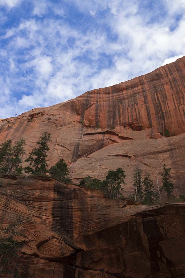
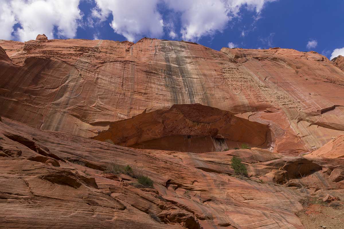
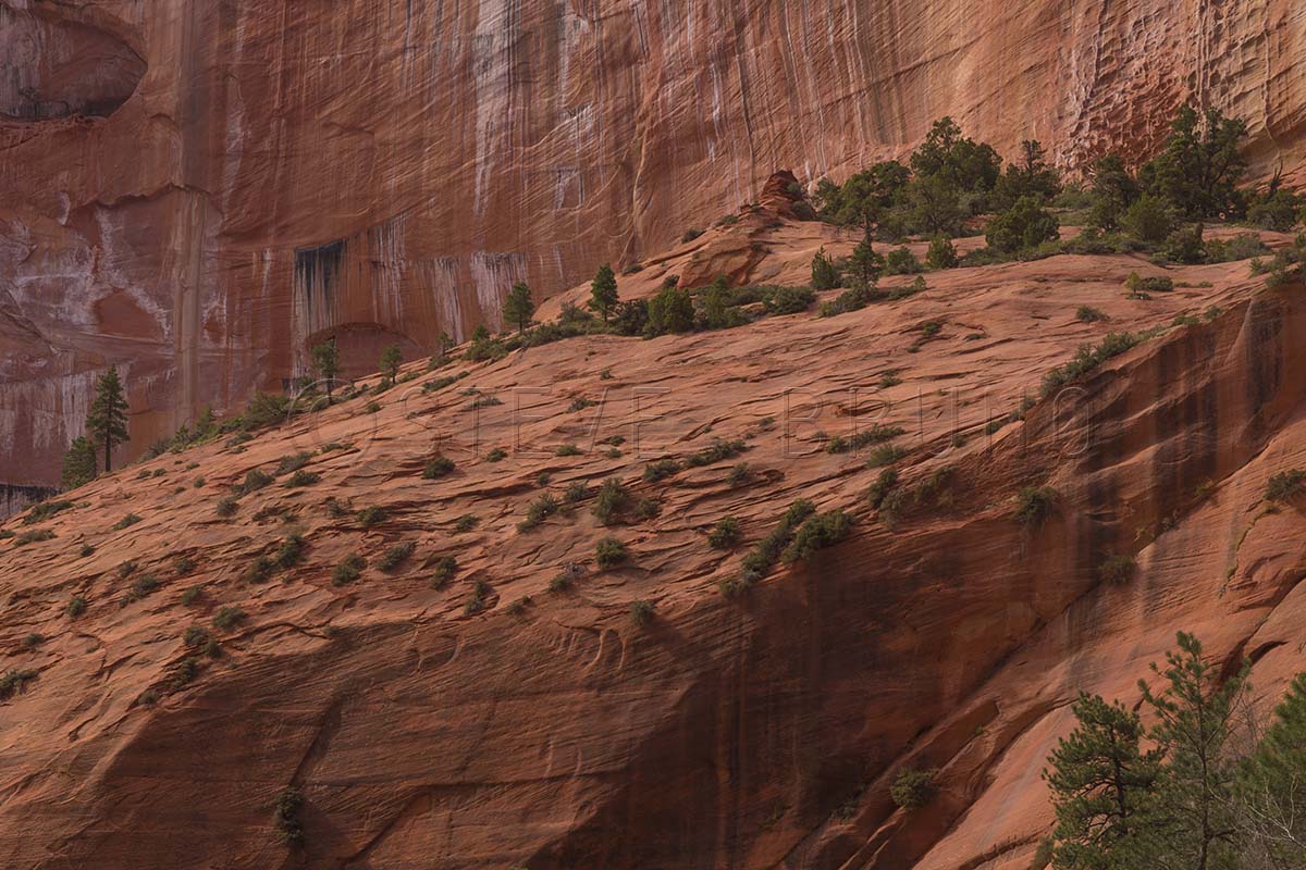
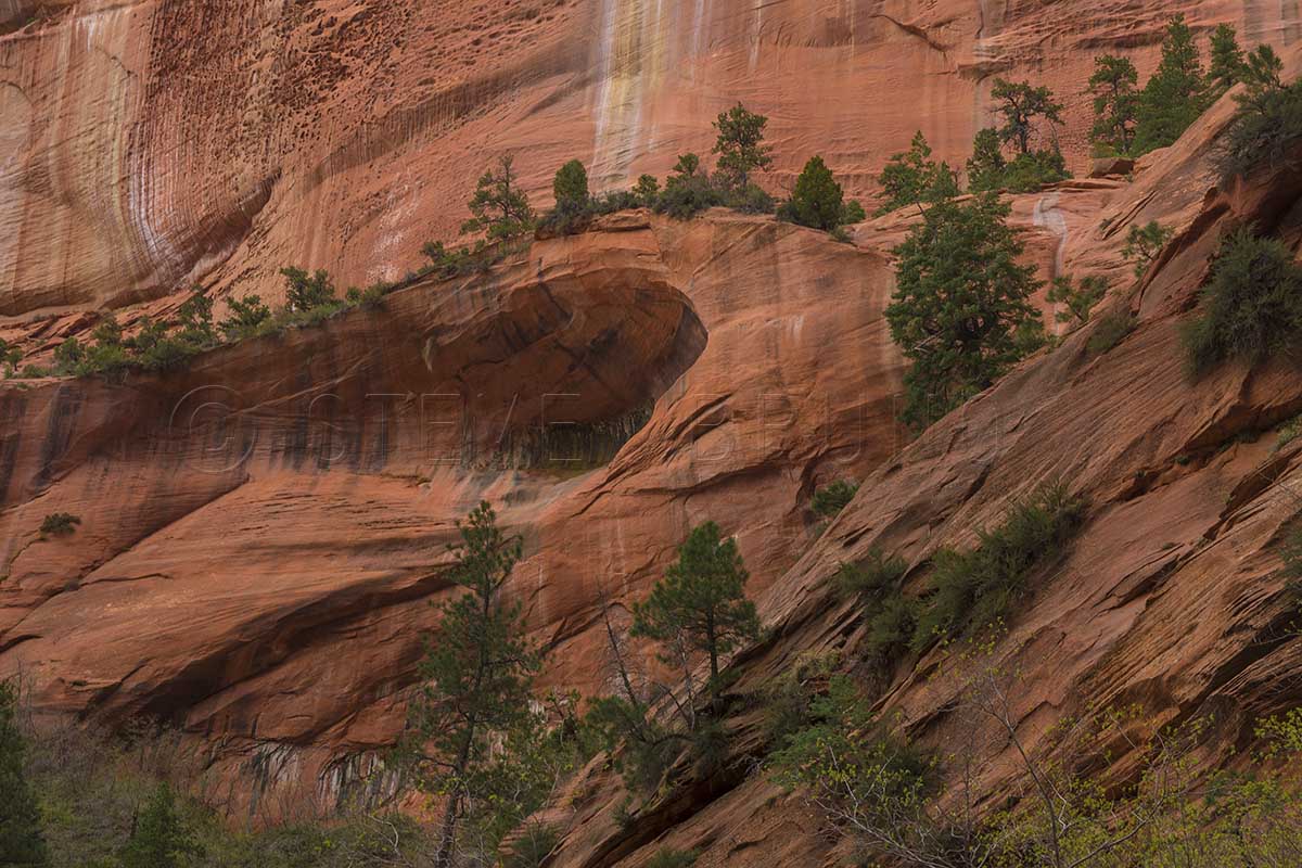
The trail started out in relatively open country and we could see higher canyon walls ahead. The easiness of the trail soon had us at an old cabin along the way. It didn’t seem like it was much longer when we arrived at Double Arch Alcove. This was an impressive sight and the depth of this beautiful canyon had become obvious. As we continued further up, there was a physically demanding spot or two, enough to keep the average tourist back. Then, our first unexpected sight came up. It was a large snowbank at the base of the canyon where water was trickling down. The cool air announced its presence before we had sight of it, and the snow was a bit on the mushy side, as one would expect in 80 degree air. We continued upward, and as we neared the end of our route we encountered another snowbank. This one, however, was completely different. It was several feet thick and rock hard. We referred to it as the desert glacier, and were estimating that it was still going to be there in June when the temps hit 100. It was shaded by steep walls of the final narrow box canyon. At the end of this box canyon were colors and textures that neither one of us had ever seen, and in a canyon so dark we needed a flash to capture it properly.
As we headed back, we couldn’t help but notice that there was a cloud or two floating above. The weathermen rarely get it right, and this day was no exception. By the time we got back to Double Arch Alcove, there was more cloud than open sky, and the light was becoming great for photography. Usually I’m the one who holds other hikers back under these circumstances, but Dave was fascinated with the changing light as much as I was. A hike which we should have finished in another 45 minutes took us almost 3 hours. Most of these photographs are along the official trail.
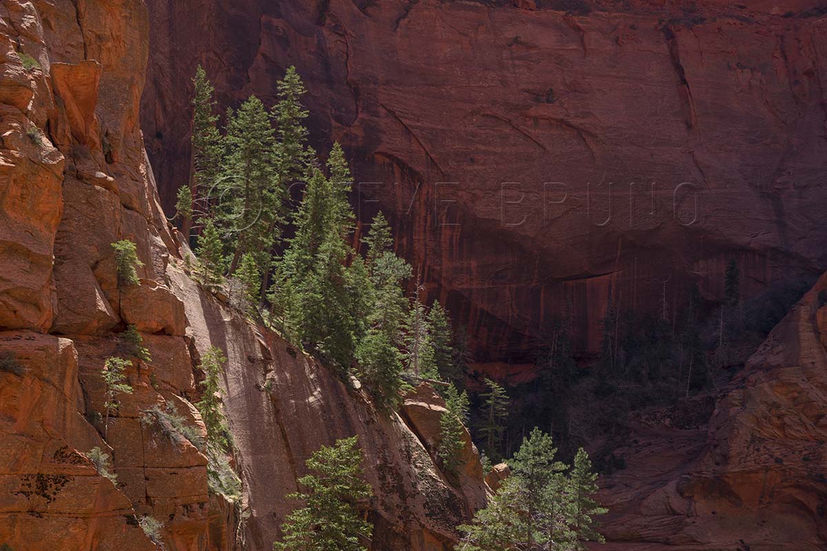
Pine trees on a ridge near the end of Taylor Creek Canyon, Zion National Park, Utah. Photo by Steve Bruno
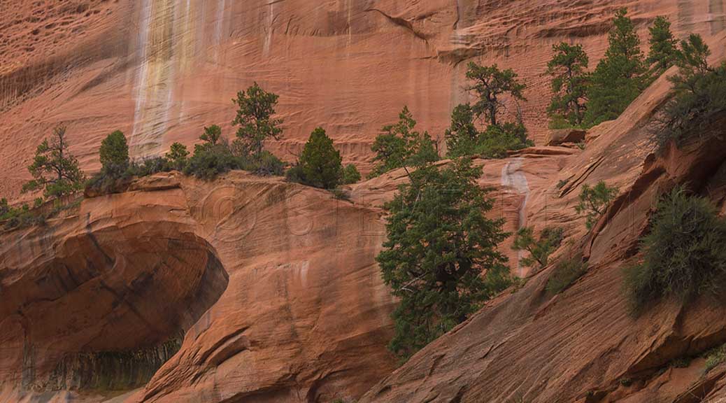
A trickle of water slides down wall of Taylor Creek Canyon, Zion National Park, Utah. Photo by Steve Bruno
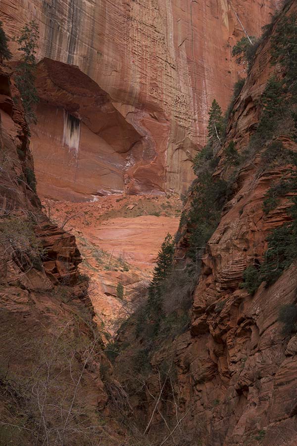
Taylor Creek Canyon ends in a tight box canyon with some strange colors and textures on the walls. Zion National Park, Utah. Photo by Steve Bruno
Desert Glacier? This very firm snowpack remained as the desert was heating up. Taylor Creek Canyon, Zion National Park, Utah. Photo by Steve Bruno
Alcove in wall of Taylor Creek Canyon, Zion National Park, Utah. Photo by Steve Bruno
Wall streaked with desert varnish in Taylor Creek Canyon, Zion National Park, Utah. Photo by Steve Bruno.
Alcove in wall of Taylor Creek Canyon, Zion National Park, Utah. Photo by Steve Bruno
Textures and vegetation of Taylor Creek Canyon, Zion National Park, Utah. Photo by Steve Bruno
A small alcove in Taylor Creek Canyon, Zion National Park, Utah. Photo by Steve Bruno
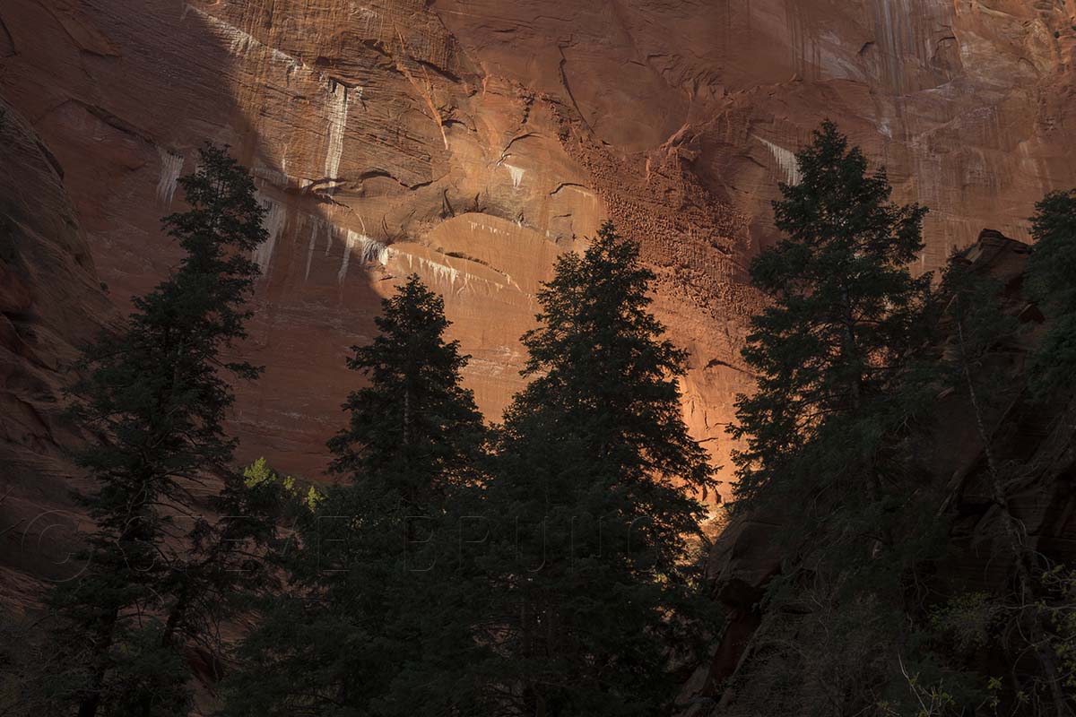
A shaft of sunlight breaks through the clouds and illuminates wall in Taylor Creek Canyon, Zion National Park, Utah. Photo by Steve Bruno.
From shadows to sunlight – walls of Taylor Creek Canyon, Zion National Park, Utah. Photo by Steve Bruno
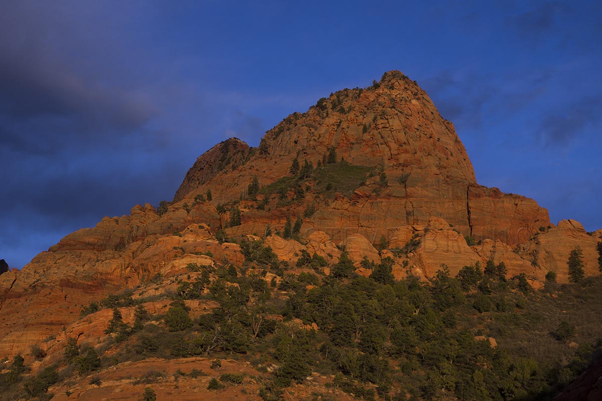
Sunset light breaks through the clouds onto the Kolob Canyons section of Zion National Park, Utah. Photo by Steve Bruno.
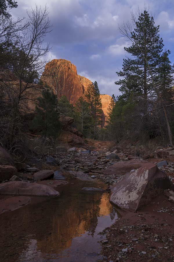
Taylor Creek near the trailhead, as late afternoon light shines on the cliffs beyond. Zion National Park, Utah, photo by Steve Bruno.
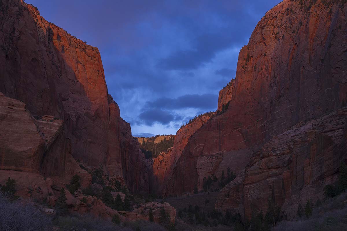
Last light of the day on cliffs of the Kolob Canyons section of Zion National Park. Photo by Steve Bruno.
As we got back to the car, we knew we only had about a half hour before sunset, and we couldn’t leave just yet. We drove into the park about another mile and found a couple great spots to get more photos as the sun was going down. Afterwards, we headed down to St. George and filled up on a healthy dose of comfort food. What better way to finish out a very good day?
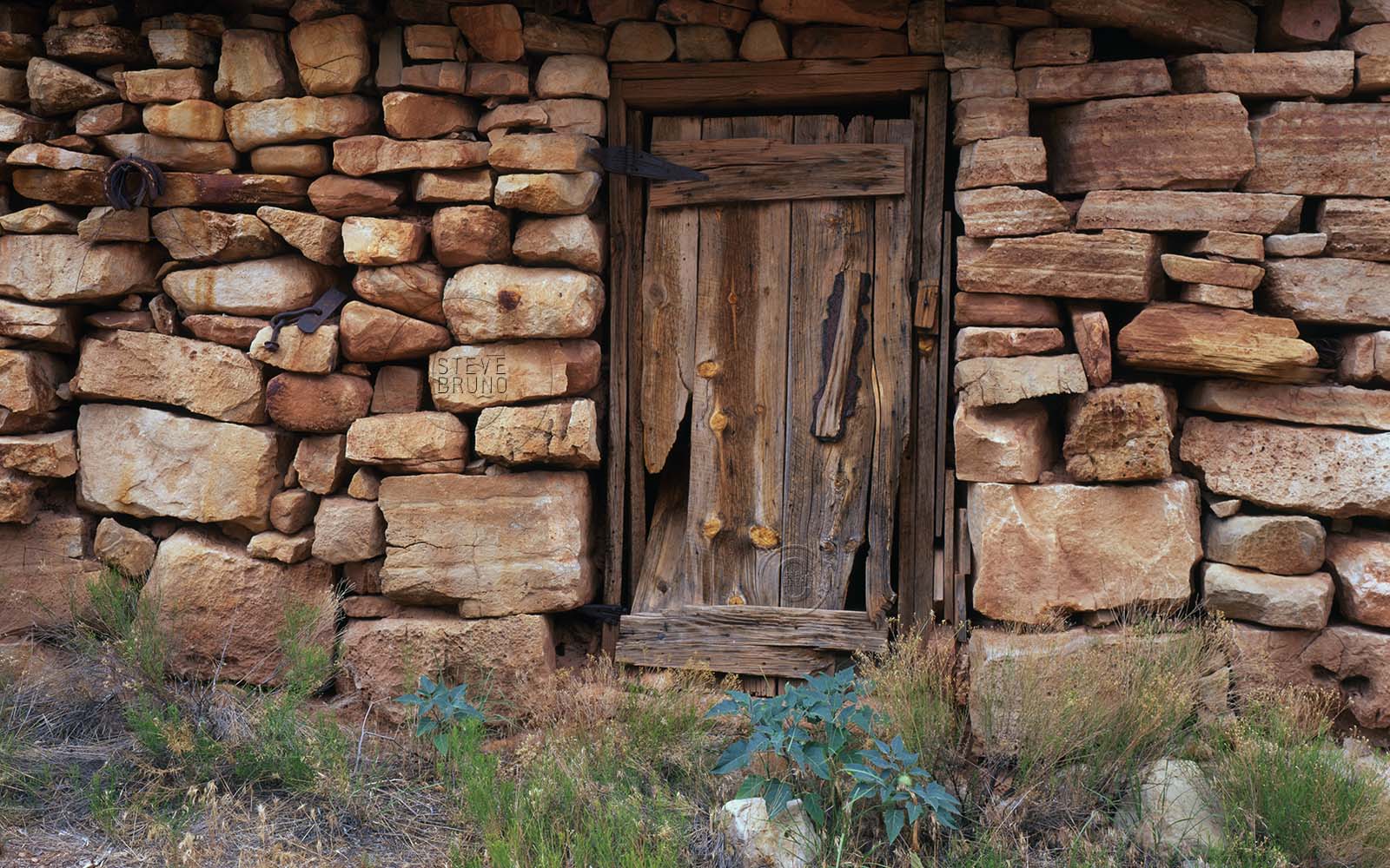
Door to Eddie’s Place in the Kanab Creek Wilderness, western Grand Canyon by Steve Bruno
Welcome to Eddie’s Place. There are no roads here, and you will have hiked at least ten miles to get here. Deep in the Kanab Creek Wilderness on Grand Canyon’s western edge, the building comes as a surprise along the route to most visitors. Eddie was a veteran who returned with leprosy, and was given the chance to live out his years far away from society. This was long before any wilderness designation was assigned to the region. It’s been over ten years since I visited last, but I have a feeling this durable structure is still intact. I feel sorry for the mule that had to bring in the cast iron stove, however.
In response to The Daily Post’s weekly photo challenge: “Door.”
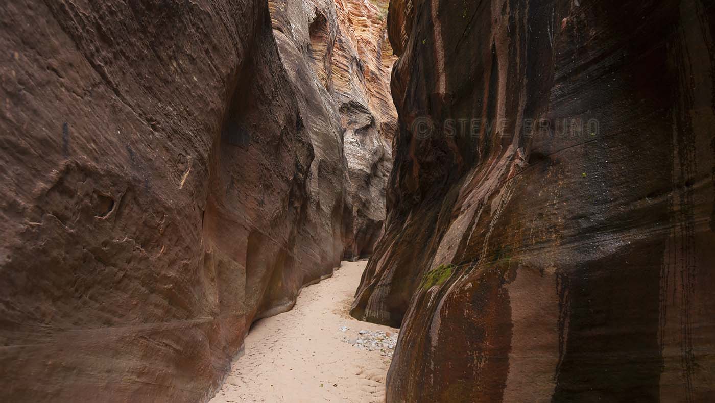
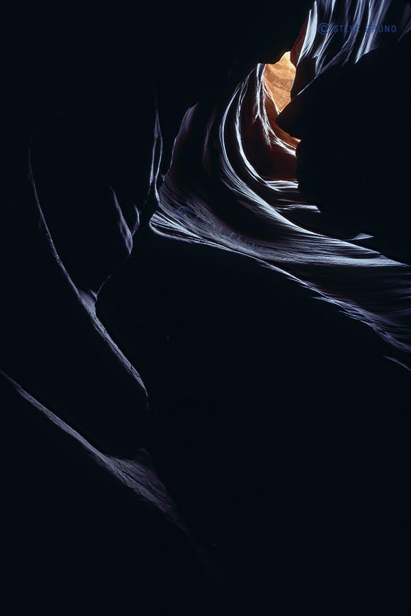
I’ve hiked many miles, and early on I discovered I preferred canyon hikes over those on a mountaintop or ridgeline. It’s not just about having shade or water, but more of the adventure of coming around a corner and being amazed with something unexpected. And while canyon exploring tops my list, some canyons are more memorable. Those are the ones where the skies disappear and I might have to take off the pack and step sideways for a moment or two. At that point, it’s hard not to feel enveloped in the land. Sometimes it’s challenging to find an angle to photograph these spots, because there’s no moving around for a better angle, and looking up just yields a washed out image. Whether it’s a slot canyon or just another thin slit in the earth’s crust, sunlight rarely penetrates to the bottom. If it does, the contrast is too much, so the best light is often reflected sunlight.
Here are some of my favorite places to become enveloped:
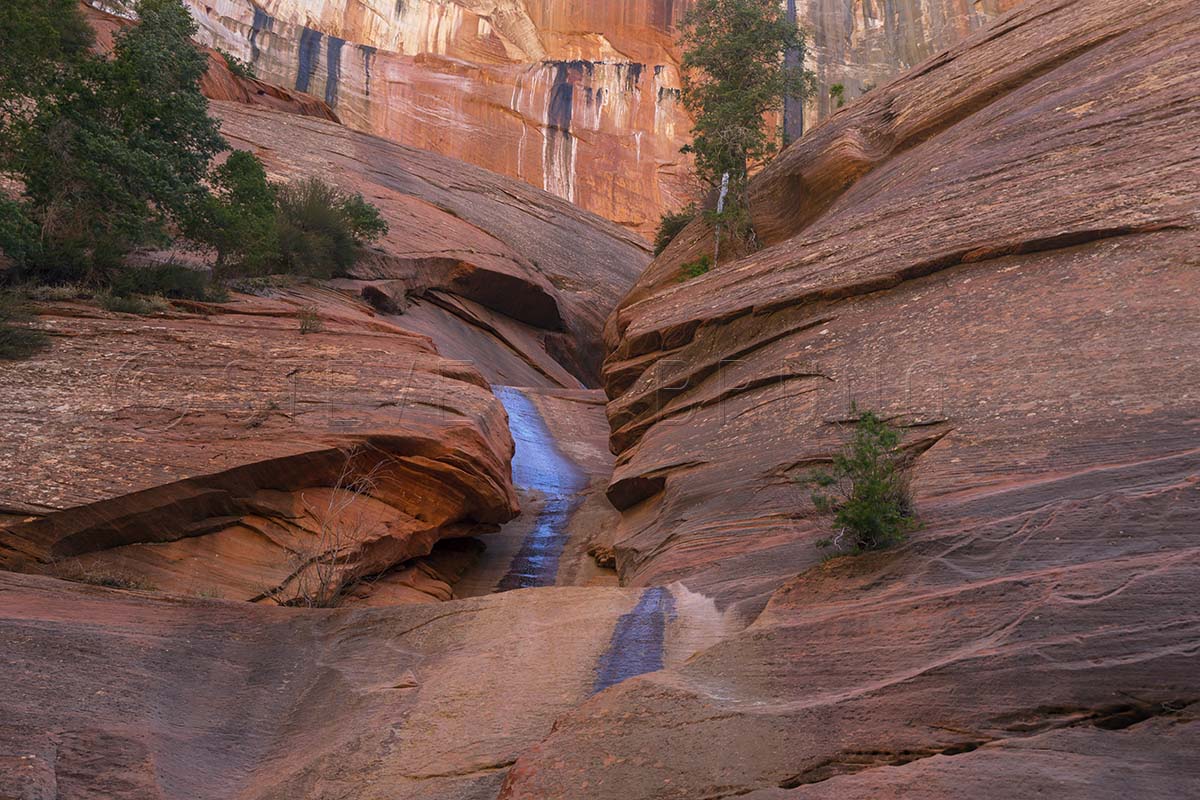
Top: small side canyon in Zion National Park, Utah
Second: Antelope Canyon, near Page, Arizona
Third: Cathedral Gorge State Park, Nevada
Fourth: unnamed canyon in Navajo Indian Reservation, Arizona
In response to The Daily Post’s weekly photo challenge: “Enveloped.”


You must be logged in to post a comment.